header-image

An Interview with Denis Wood

[Cartographer]
“WHAT ARE THE CHARACTERISTICS OF NEIGHBORHOODNESS?
Ideas that are total horseshit:
That there is a universal language
That mapmakers’ hands are clean
That “I’m me”
header-image

An Interview with Denis Wood

[Cartographer]
“WHAT ARE THE CHARACTERISTICS OF NEIGHBORHOODNESS?
Ideas that are total horseshit:
That there is a universal language
That mapmakers’ hands are clean
That “I’m me”

An Interview with Denis Wood

Blake Butler
Facebook icon Share via Facebook Twitter icon Share via Twitter

Since 1972, Denis Wood has published numerous articles, books, and lectures aiming to broaden the public conception of cartography. His book and curated Smithsonian exhibit, The Power of Maps, criticized the notion of the map as a neutral reference material and revealed the governmental and legal biases behind the most innocuous-seeming topographical illustrations. He sees the map as a unique tool able of conveying surprising information on a 2-D plane and to be an artwork of aesthetic sublimity. His maps are, he insists, arguments.

Wood’s most recent book, Everything Sings: Maps for a Narrative Atlas, is a collection of visual representations of Boylan Heights, the small North Carolina neighborhood where he raised his children. Instead of standard data-based images, these maps depict the neighborhood as an aggregate of literally endless forms: the light that fills the streets, the delivery routes of local newspapers, the faces of pumpkins in front of homes at Halloween. The result is an impression of the lives of the people of Boylan Heights, and the influence of terrain upon them.

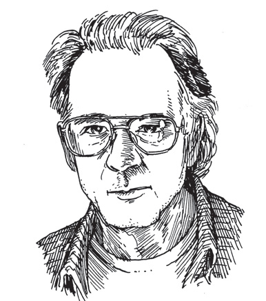
Recently, I spoke to Wood over the phone about Google Maps, Civil War battlefields, Philip Pullman’s The Golden Compass, and the unexpected ways in which maps dictate our daily lives.

—Blake Butler

I. “WORDS MELTED ONTO THE LANDSCAPE LIKE CHEESE ONTO BREAD IN A FRYING PAN.”


THE BELIEVER: In the introduction to Everything Sings, you mention how Mercator’s idea of the atlas was this “cosmographical meditation of encyclopedic proportion,” meant to contain everything, but instead, it became a reference manual, an apparatus of supposed fact.

DENIS WOOD: Mercator had this idea of making a gigantic “cosmographical meditation of encyclopedic proportion” on the universe—that was a huge desire of his—but it wasn’t connected to any obvious commercial outcome. But from the very beginning, he sold the maps. And when he died¾he died before the atlas was ever finished, before even the map part of the atlas is finished¾the plates are sold, they turn into commercial gold. It happened really rapidly. They sell like crazy. So it’s about selling paper, and the things they can sell most easily are these maps. They’re decorative, they’re informative, and they’re modern. So they just move, and they go through edition after edition after edition, and are still being printed and published. So I think that’s what happens: the great glory of writing the encyclopedia of the universe is this mad, delusory dream, whereas maps are a way of turning industrial cellulose into money, by printing information on them, and selling them. Mercator was going to have a chronology of world history, a chronology of ancient history, he was going to write ancient history, he was going to have all kinds of compendia. It was really going to be this gigantic thing that would’ve been a commercial impossibility. Nobody would have bought it.

BLVR: It seems like – particularly in Everything Sings – even if you lived to eternity you could make new maps constantly and never really finish. It’s an endless cycle because certain of the maps¾for instance, the map where you document the color of the leaves on a particular tree in the fall ¾you could come to that tree every year and it would be different.  The amount of information out there and how you parse it is unending.

DW: It’s endless. In Everything Sings, it’s endless for this little, teeny piece of territory, but it’s far more endless if you want to do anything much larger, for the world. Weather maps are being updated less than hourly at this point. That’s continuous, ongoing, real-time mapping that’s going on with respect to the weather. And the number of maps that are produced are totally insane. But what’s climate? Climate is long-term weather. And of course our climate knowledge is compiled out of daily and increasingly hourly records of the weather, everywhere. That’s how we get climate. Same thing for traffic patterns. So it is being archived, and the result of these archives are these higher levels of what we think about as knowledge. Instead of weather, we have climate.

BLVR: When I first started looking at Everything Sings, I was thinking about how people always say, “a picture is worth a thousand words,” and I had always thought that that was an asinine statement. Because the whole value of a word is that is represents something that is not picturable—it enters your brain in a different way from a picture. But a map is somewhere between the picture and the word. Your statement that “a map is an argument” is really intriguing for that intersection.

DW: If you compare Google Earth and Google Maps, for example, Google Earth in its naked, unlayered form is a bunch of pictures. They’re not maps. You have no idea what you’re looking at, and to the extent that you do have some idea, it’s something you’re bringing to the image. Pictures and words don’t have anything to do with each other. If you look at Google Maps, on the other hand, or an annotated version of Google Earth, which turns it into a map—there’s a label that says this is a desert, this is a mountain, this is a river, this is Kazakhstan, this is Mongolia—well, that’s what makes a map something other than a picture, and I think it’s one of the key problems in people trying to think about what a map does or what a map is: they see through the layer of words on the map to what they imagine is the landscape. That is to say, when I say, “see through it,” it’s like the words aren’t there. The words are so taken for granted that they become melted onto the landscape like cheese onto bread in a frying pan, and then people can’t take them apart anymore. They don’t realize that they’re seeing somebody’s interpretation of those marks. They say, “Oh, that’s a mountain,” because it says Mount Ararat, or whatever. And that’s what the map gives you: the map gives you the human landscape as opposed to the land. It doesn’t give you the land. It gives you a human eye of the landscape. A photograph does that through its selectivity and its bandwidth, etcetera, but it doesn’t give you much. It gives you much less. A map is all about naming and claiming and saying what things really are. There’s a huge arrogance that’s built in the map that “we can name and claim.”


II. DA VINCI’S ATOMS


BLVR: One of the things that you say in this book is that, “Signs are for strangers.” Like if you live there and the place is part of you, you don’t need the sign to tell you this is Walker Street.

DW: Right, you don’t. The signs are for strangers, and that’s one ostensible aspect of it. But another aspect of it is that you don’t need to have the street sign, but you need the number on your door, so it can be attached to this grid so that the mailman can deliver you the mail, or the mortgage forecloser can foreclose on your property appropriately.

BLVR: You’ve referred to the presence of signage as one of the big shifts in maps, when they leaned away from narrative and toward data, because people begin to look more at the language and symbols rather than the terrain, which makes it odd to translate from representation to reality when you are out walking around in the world.

DW: And you could walk around and not know the names of the streets and not care, because you’re just wandering around. You get to a new city and you leave the hotel, you’ve got two hours before something happens, so you just wander around. You don’t pay any attention to any names of the streets, but you conserve a memory of turning left or turning right, or some landmark in sight. You don’t need to know the names. You don’t know what the buildings are, then you might say to somebody who you meet for dinner, “Wow, there was this really interesting building that I saw, and it was this and that,” and your dinner partner says, “Oh, that’s the Seagram building,” or whatever, and begins to attach words to it, and a history and a story gets piled onto it. But you didn’t need that when you were just walking around. But you need it for everything else: for building it, and addressing it, and documenting it: all of those things require words. We’re really talking about semiology, you know. The sign doesn’t speak for itself. This is one of the great shibboleths of both maps and graphics in general; the idea that there is this universal language they speak, but that’s so much horseshit. There is no universal language. They all need to be read and interpreted.

BLVR: If someone who didn’t have any previous knowledge of the language came across a stop sign, they would just walk right past it.

DW: Right. They had a similar problem when they sent that plaque, the Voyager Golden Record, out into the universe on the Voyager shuttles. They had to figure out some way of communicating with entities that don’t know language. They struggled to come up with these signs that would be somehow meaningful anywhere in the universe. [laughing] I find these projects so delusory. You know, one of the things I cheated on when making this atlas is a lot of the maps don’t have any words on them. But they don’t have words on them because they are in a sequence of other maps, which do have text associated with them. If you were just to show the pumpkins that are on the cover… I mean, what the hell is that? There’s no way of knowing that’s a map. It only becomes mapful in the context of all of the other maps. So the idea of the atlas as a structure that gives meaning to individual maps, which I also write about in the beginning, is essential to this project. Otherwise all of these maps would have to have little labels on them, and the pumpkins would have to have addresses on them, but that is so far from the point. We are people of words, and we think in words, and that’s how we know the world—through words.

BLVR: Another idea I found interesting in Everything Sings came out of your statement, “Any order will give rise to narrative.” To me the more interesting narratives always come out of letting the smaller pieces intuitively or structurally speak for themselves, rather than speaking for them. I’m always skeptical of people who are too possessive of that ego that they created something. The human as a filter is, I think, more interesting than the human as an ego.

DW: As a geographer, I continuously focus on the material idea of a person, on where the person literally comes from, that is to say, the lettuce from California, the beef from Iowa, and so forth and so on. I want to see the person trailing these sort of fibers of connectivity off into the universe so that we can really see the individual as somebody who comes together momentarily out of a whole bunch of things that are tied to the world in many complicated ways.

When I was a kid I read Walt Disney’s Our Friend the Atom. It had an image of Leonardo DaVinci breathing and having so many atoms of oxygen pass through his body in his lifetime, and these things are exhaled and they get caught up in the atmosphere, and the stochastics of thermodynamics means that they get spread all over the place. So, every time you inhale, you inhale 200 atoms that were part of Leonardo DaVinci’s body. As a child I’m like, “Holy god! What does that mean? Does this mean that Leonardo DaVinci is dispersed?” And yes, it does. In an atomic sense, he is literally dispersed into the universe. There’s that wonderful image in one of Phillip Pullman’s Golden Compass books where they let all the souls of purgatory. They go down to purgatory and open the back door and let all these souls just slip out into the universe, and as they slip out into the universe they’re dissipating, of course, and then there’s nothing left of them at all, because there is no heaven. That’s one of Pullman’s points. And as they move to this point of dissipation, they all acquire a kind of beatific Thank god, I finally get to dissolve myself into the what all of the universe, whence, of course, they came. The whole idea that I’m me is preposterous.


III. 11-YEAR-OLD PREADOLESCENT MALES


BLVR: A lot of these maps were made using information that others helped you gather, correct?

DW: Most of these maps were done in class with students.

BLVR: So you’re working with a team of other people, basically to make a portrait of a place where you spent a large part of your life.

DW: I lived there for twenty-five years. My kids grew up there. It’s a portrait of that place in maps. But I also thought about it from the very beginning as something else. I’m a geographer, and it’s true that I was teaching at a design school. That’s one reason I think the maps are so much cooler than maps that come out of geography programs, because design students have a need to declare themselves in graphic form, whereas the cartographer has a need to make himself disappear in graphic form. The scientist, yes, wants to say, “I had this idea,” but he wants to pretend that he is merely a conduit for the data which he was smart enough to identify. He makes some claim on it that allows it to be attached to his name, but basically, it’s the data. “This is the real world! This is true!” is what he’s saying. Whereas a designer, he’s coming from a wholly different perspective. He’s saying, “This is me.”

Besides that, I wanted to think about what a neighborhood is. What makes a neighborhood a neighborhood? What are the characteristics of neighborhoodness? There’s a theorist named Leonard Bowden who had the idea that neighborhoods are created by eleven-year-old preadolescent males. In their running through the neighborhood and connecting families together, crossing fences, going into homes that their parents wouldn’t go into, and knowing people that their parents would never even acknowledge, they create the neighborhood. Not girls, because girls were not given the privilege of ranging like the boys were, and not older boys, because they were being directed by the school toward classmates at a distance.

Now, that’s just one idea of how you can think about what pulls a neighborhood together, what gives it its identity, its structure. What the students and I came up with, working with these maps, was that what the neighborhood did was transform the human being who is a citizen of a city into this individual who lives in this neighborhood, who has these kinds of relationships with these kinds of people, who sits in this particular way on his front porch in the morning when the sun shines on it. At the same time, it takes that limited individual and turns him into a citizen participating in this much larger social structure—a social structure that’s too large for anybody to get his head around.

BLVR: Where I live, if you drive a little bit north, there are all these fields where the Civil War was fought, and there are all these signs demarcating the individual battles and what happened where and when, and how many people died. But it just looks like some grass-field where the power lines that connect the neighborhoods are hung. There the signs give all this context, but otherwise it looks like just another empty field. It seems like there’s no great way to directly quantify what went on there.

DW: You’d have to build statues of soldiers dying and writhing in the fields. Look at the Korean War monument in Washington. It’s just a piece of grass with these soldiers, and they’ve got guns in their hands and they’re advancing. But they’re not dying or anything, which is the grizzly reality of every one of those Civil War fields.


IV. “YOU CAN DO BAD THINGS WITH A TOOL AND YOU CAN DO GOOD THINGS WITH A TOOL.”


BLVR: What about your colleagues in the world of mapmaking – is there a big clash between you and more traditional geographers, who are making maps to sell in books of data?

DW: Many people don’t like my insistence—which goes back into the very early 1980’s—that maps are political; that maps exhibit and promote a political orientation. They’re about something. They have an agenda. There are a lot of mapmakers who really object to that. And this is in 2011, when my colleagues and I have been at this critical thing now for twenty years, which has largely been accepted. It’s the new cartographic dogma that maps are interested and have perspectives and make arguments and things like that. But when I say at a meeting of cartographers that maps aren’t representations, it’s very usually the case that the first person who stands up to ask a question says, “How can you say that maps aren’t representations?” They just can’t get their head out of the place it’s been in and get it to someplace else.

Also, a lot of them don’t want to acknowledge any complicity with the way things are, and maps have a huge deal to do with the way things are. They want to pretend their hands are clean: It’s just a tool. But you can do bad things with a tool and you can go good things with a tool. I’ve been suggesting to the hardest edged people of all that they could put their epistemological and ontological arguments on a really firm foundation by simply acknowledging the fact that they are making the world. And they recoil from that, viscerally and instinctively, as they continue to make the software that enables them to make the world. In explicit terms, some of the most brilliant analyses of how maps do what they do have been carried out by these people who are basically building machines to make maps. When someone drops a bomb on something and kills a bunch of kids, and they did that using a map that you made. You either accept the responsibility for it—a kind of, “Well, you can’t make an omelet without breaking some eggs,” responsibility—or you say, “Damn it, I can’t do this anymore.”

BLVR: The maps you make in Everything Sings exist on a more personal terrain than a war map—I wonder whether the process was ever potentially emotional for you. I imagine a map could even be terrifying, even, revealing certain things based on information you collected, about this place where you lived.

DW: The problem with making the map is by the time you’ve decided, “This is something that constitutes data,” and you’ve collected it, and you’ve massaged it to the point where you can make a map out of it, you already know the worst that’s going to come out of the map. When you’re working at the scale I’m working at, you’ve already decided up front that you’re going to record locations of wind chimes. Now, it might be somewhat of a revelation to actually map them out, but it’s not going to be shocking or anything.

But I’ve seen maps that I find completing terrifying. Uranium minings and various illnesses in the Navajo reservations—they’re just insane. They just make you furious. Bill Bunge’s map—that I still think is one of the great maps, the map of where white commuters in Detroit killed black children while going home from work. That’s a terrifying map, and that’s an amazing map. He knew that. They had to fight to get the data from the city. They had to use political pressure to get the time and the exact location of the accidents that killed these kids. They knew what they were looking for. I didn’t have anything to do with that project, so when I saw the map for the first time, it was like, “Oh my god.” It’s such a powerful image, to see maps like that. I think that’s the power of maps, or one of the powers of maps: to make graphic—and at some level unarguable—some correlative truth. We all knew that people go to and from work. But to lay the two things together reveals something horrible.

BLVR: It’s an argument, like you said.

DW: It sure as hell is. Maps are just nude pictures of reality, so they don’t look like arguments. They look like, Oh my god, that’s the real world. That’s one of the places where they get their kick ass authority. Because we’re all raised in this culture of, if you want to know what a word means, go to the dictionary, if you want to know what the longest river in the world is, look it up in an encyclopedia, and if you want to know where some place is, go to an atlas. These are ALL reference works and they speak “the truth.” When you realize in the end that they’re all arguments, you realize this is the way culture gets reproduced. Little kids go to these things and learn these things and take them on, and they take them on as this is the way the world is.

More Reads
Interviews

An Interview with Mindy Kaling

Mindy Kaling fantasizes when she jogs. That’s one of the things that makes her just like all of us, at least all of us who find jogging very boring: that is to say, all of us. ...

Interviews

In Conversation with James Franco

Carter
Interviews

An Interview with David Altmejd

Derek McCormack
More